Analysis: China's new map a timed move to reassert its territorial claims, flex muscles ahead of regional summits
https://www.channelnewsasia.com/asia/china-new-map-territory-g20-asean-summit-india-malaysia-russia-indonesia-protest-3737366
Analysis: China's new map a timed move to reassert its territorial claims, flex muscles ahead of regional summits

- New map reasserts China’s claim of Taiwan, overlaps territory with India, Malaysia, Vietnam, Russia and others
- Analysts say China is applying pressure on participants for the ASEAN and G-20 summits by advancing territorial claims
- Tensions could develop at the disputed territories between local forces and China’s military, according to a political expert

JOHOR BAHRU: China’s decision to publish a new map that lays its claim over the disputed South China Sea as well as land areas contested by India and Russia too is timed to cast a spotlight on these issues and reassert its position ahead of multilateral summits, say analysts.
The Association of Southeast Asian Nations (ASEAN) Summit is scheduled for Sep 5 to 7 in Jakarta, Indonesia while the Group of 20 (G20) Leaders’ Summit will be held in New Delhi, India from Sep 9 to 10. Chinese leaders are expected to attend both events.
Mr Allan Behm, director of the International and Security Affairs Program at The Australian Institute, said China’s intention for releasing the map at this time is akin to “stirring the pot” while keeping the issue of its territorial claims “on the boil”.
“With a number of important regional meetings about to take place, China appears to wish to re-apply pressure on conference and summit participants by advancing its (territorial) claims once again,” Mr Behm told CNA.
“The claims do not assist in bringing the discussions about competing claims any closer to conclusion. Neither does their re-assertion (further) complicate the negotiation of the current disputes and disagreements. It merely keeps them front of mind,” he added.

TIMING ‘TYPICAL OF CHINESE DIPLOMACY’
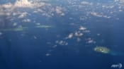
China’s Ministry of Natural Resources on Monday (Aug 28) issued the "China Standard Map Edition 2023", which lays claims over large swathes of the South China Sea also disputed by Malaysia, Vietnam, the Philippines and Brunei, as well as several land areas in India and Russia.
China’s new map also revives the use of a “10-dash” line - with an additional dash to the east of Taiwan - a break from the usual nine-dash line Beijing has been using in recent years to stake its claims over large swathes of the South China Sea.
The map has drawn protests from the Indian, Philippine and Malaysian governments while Indonesia, though not a claimant-state but has its Natunas within the nine-dash-line, has said it is seeking clarity on the issue.
On Thursday, China’s foreign ministry spokesman Wang Wenbin reportedly said it hopes that “relevant parties” can see its new standard map in an “objective and rational way”.
Political analyst Professor James Chin from the University of Tasmania told CNA that this move by China to push this agenda prior to the summits is “typical of Chinese diplomacy”.
“Timing is very important. The Chinese want this to be a talking point at the summits and want to show that they are consistent in claiming these territories as theirs,” said Prof Chin.
He also noted that the Permanent Court of Arbitration in 2016 found the nine-dash line to have no legal basis, and that China’s move in publishing a new map with a 10-dash line is a signal to the international community that “it does not recognise the ruling” and that it is willing to dig its heels on its claims.
Mr Alexander Neill, a Singapore-based defence analyst and adjunct fellow of Hawaii's Pacific Forum think-tank, told CNA that China reasserting its territorial claim ahead of the summits makes clear that it is still “resolutely determined '' to enforce them.
“China may have been seen to have ceded territory from (when its empire was largest) during the Qing dynasty in the 18th century,” he added.
“In a much more nationalistic light, I think (China’s president) Xi Jinping is reinforcing China’s historic claims and also reinforcing this irredentist view of retrieving territories (of countries which) may be vulnerable,” said Mr Neill.
DISPUTES WITH INDIA, RUSSIA AND ASEAN STATES
The Australian Institute’s Mr Behm said that the additional dash appears to be China’s re-assertion of its claim to Taiwan as part of China.
“It clearly includes Taiwan within its ocean boundaries, lest any country imagine that China has wavered at all on its claim to Taiwan,” he said.
Mr Behm noted that while China’s claim to Taiwan is well documented, there have been questions over how countries will react if China were to “seek to reintegrate Taiwan forcibly”.

As for India, Mr Neill said the new map, in asserting China’s claims to the Indian state of Arunachal Pradesh and the arid northern extension of Ladakh in Aksai Chin, touches an “extremely sensitive area that has been the focus of physical clashes between China and India over the years”.
He also outlined how the 10-dash line asserts China’s claim to islands in Southeast Asia, including Indonesia’s Natuna Islands, which houses the country’s exclusive economic zone, and part of Malaysia’s Borneo.
The Australian Institute’s Mr Behm said that China’s territorial claims in the South China Sea - which include how Chinese activities in the waterway date back 2,000 years - are “extravagant demands”.
He said that Malaysia, Indonesia, the Philippines and Vietnam all have reasonable grounds for their claims under the United Nations Convention on the Law of the Sea (UNCLOS).
“The reefs and shoals have been traditional fishing grounds for peoples living in the archipelagos for centuries,” said Mr Behm.
“As I understand them, China’s claims are not well documented historically, and the nine-dash line itself post-dates World War II.”
On Russia, Mr Neill pointed out that the new map also includes the Bolshoy Ussuriysky Island on the Amur River and identifies it as Chinese territory.
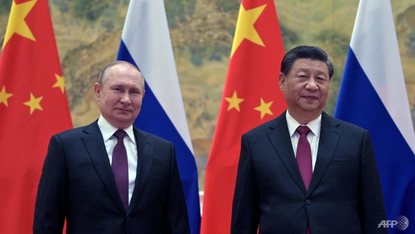
Territorial dispute between Russia and China over this area began in the 1860s and was seemingly resolved in a 2008 treaty when the western part of the island was given to China.
Mr Neill said: “China reasserting this claim on the map is an irritant to Russia, I imagine. Because you know - why dredge up this particular flashpoint which was resolved some years ago.”
“The map is significant because it risks dragging Russia into the dispute … during a time when the bilateral relationship between China and Russia is extremely sensitive,” he added.
He noted how China had signed a “no limits partnership” agreement with Russia shortly before Vladimir Putin launched Russia’s invasion of Ukraine in February 2022, which enhanced their relationship into “something short of an alliance”.
However, Mr Neill noted that Chinese officials have since publicly called for a peaceful resolution to the Ukraine war, and this is causing a fissure between Beijing and Moscow.
OBJECTIONS TO HAVE LIMITED IMPACT ON TERRITORIAL CLAIMS
While China’s newly published map has already triggered protests from other claimant-states, analysts say their reactions may intensify and could even lead to more dangerous counters in the disputed territories.
Analyst Prof Chin said it might lead to a big diplomatic blowout because the countries impacted like Malaysia will want to make loud statements to publicly reject what China is doing, though “these protests will not last as China has issued these maps before”.
“But on the ground at these disputed territories, there will be more tensions,” he added.
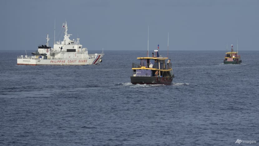
“There are likely to be more close encounters, for example in Borneo, between Malaysia Coast Guard and China navy. This could escalate further especially since the US, Australia and the British have a naval presence in the South China Sea.”
Pacific Forum’s Mr Neill said that these countries could resort to a demarche - in which the foreign diplomats of these countries “could express indignation and displeasure” to put diplomatic pressure.
He said some countries could consider doing political rallies - citing how the Philippines have organised cultural events in which patriots would come out and show solidarity towards Philippine sovereignty.
He added that some countries could express displeasure to their Chinese counterparts privately, citing how Vietnam may do this via their Communist party links.
Mr Neill said he believes India will react strongest to China’s move, with possibly big protests from Prime Minister Narendra Modi’s government.
“Modi is observing a massive uptick in patriotic sentiment and he has to respond to (China’s claims) and vocally do so,” he added.
“But I think it’s really limited what countries can do to apply any pressure on China because they are certainly not going to withdraw (their claims).
“And frankly the Chinese Communist Party leadership does not care one fig what countries think.”


Comments
Post a Comment